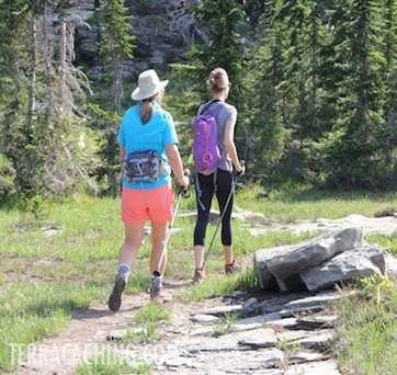

One of our members, JASTA 11, recently visited the island of Guam and was able to place three new caches on the island. Check out his latest blog post to hear all about his trip!
He hid three new caches while visiting:
Magellan’s Landing – TC4QJH Learn some island history while hunting this really cool virtual cache.
The End of Sherman’s March – TC5P6R Discover a relic of the WWII era during your hunt for this classic cache.
Punchbowl del Diablo – TC6NMJ This offset cache leads you to an enormous sinkhole. Careful around the edges!
If you have a chance to visit Guam, make sure to find these new Terracaches! We would love to hear about your adventures at community.terracaching.com. Come chat with us!
TerraCaching is often combined with member's other interests and can take us to all sorts of interesting places. Read on to discover some incredible locations through the experiences of JASTA 11:
Controlled Flight Into Terrain (CFIT): An accident in which an airworthy aircraft, under pilot control, is unintentionally flown into the ground, a mountain, a body of water or an obstacle. In a typical CFIT scenario, the crew is unaware of the impending disaster until too late.
Mountains are amazing things. We are drawn to them for their majest, for their beauty, for the challenge in taming their summits - sometimes for no other reason than 'because it's there'. Mountains are strong, unyielding, and unforgiving. This can be particularly devastating to an aircrew that has lost situational awareness.
Along with TerraCaching, mountain hiking and aviation comprise much of our interests. With this edition of The Written Log, we share some examples of where we were able to combine each of these passions:
Mount Abraham, Vermont
On June 28th, 1973, the pilot of a Cessna 182 was trying to navigate through Lincoln Gap in a cloud bank and struck the northwest slope of Mount Abraham, about fifty feet below the summit of 4,017 feet. The pilot survived the crash. According to local lore, he climbed out of the plane and walked down the mountain. Much of the fuselage structure remains intact with pieces of twisted wing metal scattered about. The engine is missing, probably hurled far away into the thick forest.
Here, you can search for TC9U3V.
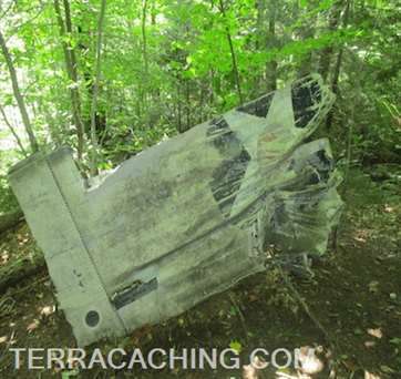
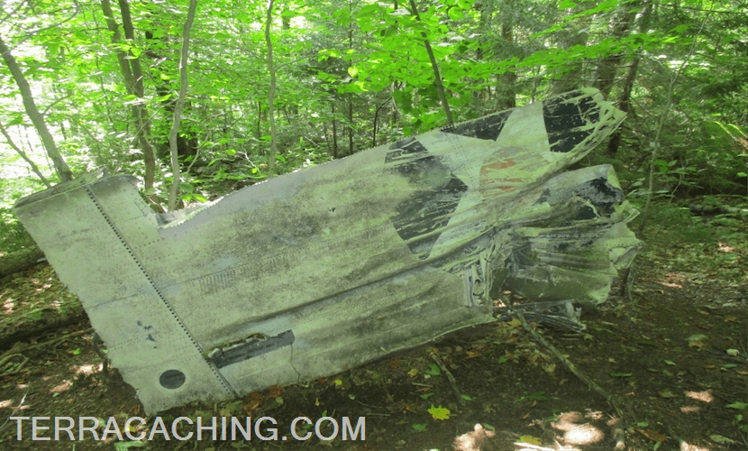
Camel's Hump B-24 Liberator Crash, Vermont
Vermont's third-highest peak was the scene of tragedy back in 1944. On October 16th of that year, U.S. Army B-24J Liberator (#42-51067) was out on a training mission when it crashed into Camel's Hump Mountain in the darkness of a moonless night, killing nine of the ten crewmembers aboard.
The sole survivor, Pvt. Jimmy Wilson, 18, of Jacksonville, Fla., lost both hands and both feet due to frostbite as he lay injured in the wreckage. He was rescued by five teenage members of the Civil Air Patrol, some 41 hours later.
Investigators found the wreckage near the top of the 4.083 mountain, the debris field covering more than an acre of land. When we visited, we were only able to find the largest piece- the remains of the right wing, now laying upside down on the slope.
Across the path, about ten feet away, TC1IB6 awaits your find!
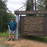
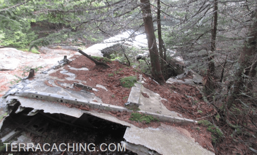
Mount Watemomee B-18 Bomber Crash, New Hampshire
The tale behind this crash had interested us for quite some time. As the story goes, on the evening of January 14, 1942, the tiny villages of Lincoln and Woodstock were alarmed by the sounds of an explosion on the side of Mount Watemomee.
That afternoon, a Douglas B18-A bomber with a crew of seven, had taken off from Westover Air Field in Massachusetts to patrol for German U-Boats some 250 miles out over the North Atlantic. Hours later as the plane was returning home in total darkness and worsening weather conditions, the crew miscalculated their position by mistaking the shoreline of Lake Winnipisaukee for the coast south of Boston.
At about 7:40pm, the co-pilot, Lt. Woodrow Kantner saw what he first thought were dark clouds. He turned on his landing lights and saw their error. he tried to warn the pilot, Lt. Anthony Benvenuto, to pull up. Benvenuto couldn't hear him and Kantner pulled up. But it was too late and the men could not prevent the disaster. The plane hit a downdraft, stalled, and flew in through trees and crashed in deep snow on the side of the mountain.

The five survivors were rescued by local residents including a doctor. A crew of woodsmen had blazed a trail up the side of the mountain, bringing along toboggans to evacuate the inujured.
We used our visit to this crash site to log LC7NP - Air Memorial.
(Years ago, there was a Groundspeak cache here, but the Forest Service had it removed due to searchers disturbing the wreckage looking for it.)
And probably the most interesting one of all...
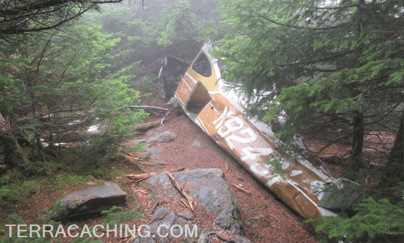
Northeast Airlines Flight 792, Mount Success, New Hampshire
The hike up to Mount Success is reason enough to come here, but just a short distance from the summit lie large portions of a crashed Douglas DC-3.
On November 30, 1954, Flight 792 departed from Boston bound for Berlin, New Hampshire with stops at Concord and Laconia, New Hampshire. On board were a crew of four, and three passengers.
Just after 11:00 a.m. the flight contacted the air traffic controller at Berlin Airport and requested weather information. The crew was advised that the weather was 3,000 feet overcast, with 2.5 mile visibility, and light snow showers. This was the last contact with the aircraft.
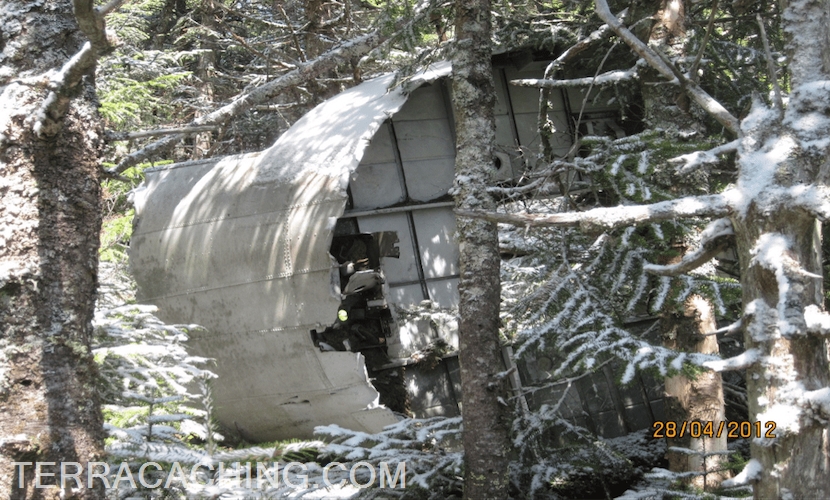
On December 2, the wreckage of Flight 792 was spotted rom the air on the southern slope of Mt. Success, 13 miles southeat of Berlin Airport, at an elevation of 3,440 feet. Two members of the crew had been killed, and the captain seriously injured, but the stewardess and the three passengers were relatively unhurt.
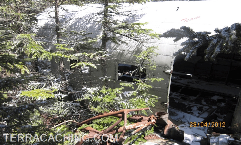
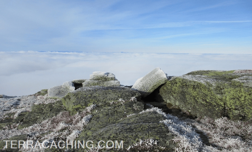
Located in the remote Mahoosuc Range near the border with Maine, the lower slopes of Mount Success are typical boreal forest of dense spruce and fir intermixed with deciduous trees. A bare granite outcropping known as The Outlook offers spectacular views into the valley below.
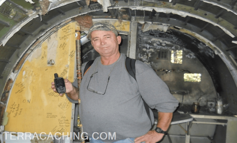
Log a photo of yourself inside the wreckage to claim a find on TCHWX.
We hope that you have enjoyed the short tour of some of our favorite special places. Whatever your interests or passions may be, there is a whole world of adventure out there to discover. All you need to do to get started is to step outside your door!
Get out there and begin your own adventure, for love of the hunt!